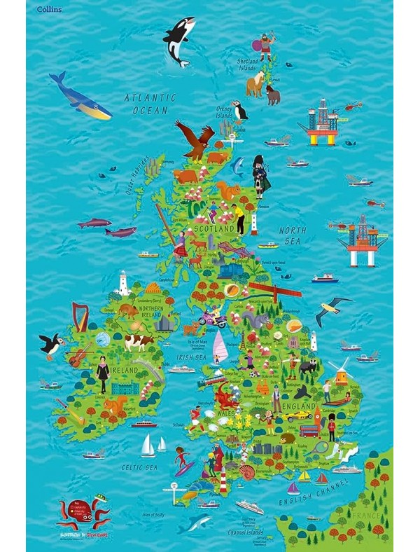
Children’s Wall Map of The United Kingdom & Ireland
- Publisher: Collins ELT
- ISBN: 9780008212087
- In general avem in stoc toate produsele afisate pe site. Exista posibilitatea ca unele produse sa nu fie disponibile. Educational Center nu este un vanzator exclusiv on-line si datorita canalelor multiple de distributie si vanzare stocul variaza si nu poate fi actualizat in timp real pe site. In astfel de situatii veti fi contactat telefonic pentru a se stabili data de livrare.
- 30.00 RON
- Ex Tax: 30.00 RON
Description
Colourful Illustrated Map of the United Kingdom and Ireland
This highly illustrated, rolled pictorial map is designed to take children on a journey of discovery around the United Kingdom and Ireland.
Stunning illustrations are used to depict themes such as national emblems, customs, food, birds, animals, buildings and sports to help younger readers gain an understanding of peoples around the world.
Illustrated by Steve Evans.

